Implementation Effort
- Requires minimal effort
- Timeline between 2-3 weeks*
* Assuming an agency has an existing, configured AASHTOWare Safety instance and all required data
Our Customer Success team helps agencies turn crash data into actionable insights. The processes below show how they’re making their communities safer.
The West Virginia Department of Transportation is using historical crash data to prioritize railway crossings across the state.
* Assuming an agency has an existing, configured AASHTOWare Safety instance and all required data
The West Virginia Department of Transportation (WVDOT) has a strong history of improving railway crossing safety in its state and is now using AASHTOWare Safety to ensure its railway crossing safety improvements target areas with the greatest impact. Since beginning this initiative, in the 1970s, West Virginia had approximately 150 vehicle/train crashes per year. As a result of their emphasis on railway crossing safety, they currently experience fewer than 20 vehicle/train crashes per year. Historically, WVDOT has relied on recommendations from their railway recommendations team, planning teams, and citizen complaints to identify areas for safety improvement.
“From 2000 to 2023 the most recent data available shows fatalities at these crossings have decreased by 41 percent. The overall reductions in fatalities come despite an increase in the vehicle miles traveled on roadways and an increase in the passenger and freight traffic on the railways.”
–FHWA Railway Highway Crossing Program Overview
With the addition of AASHTOWare Safety, WVDOT can now include an in-depth historical crash data analysis, combined with the geo-location of all crashes that occurred near railway-highway crossings. This new, data-driven approach has allowed WVDOT to target the areas with the greatest impact on railway safety in their state, continuing their legacy of improving railway crossing safety.
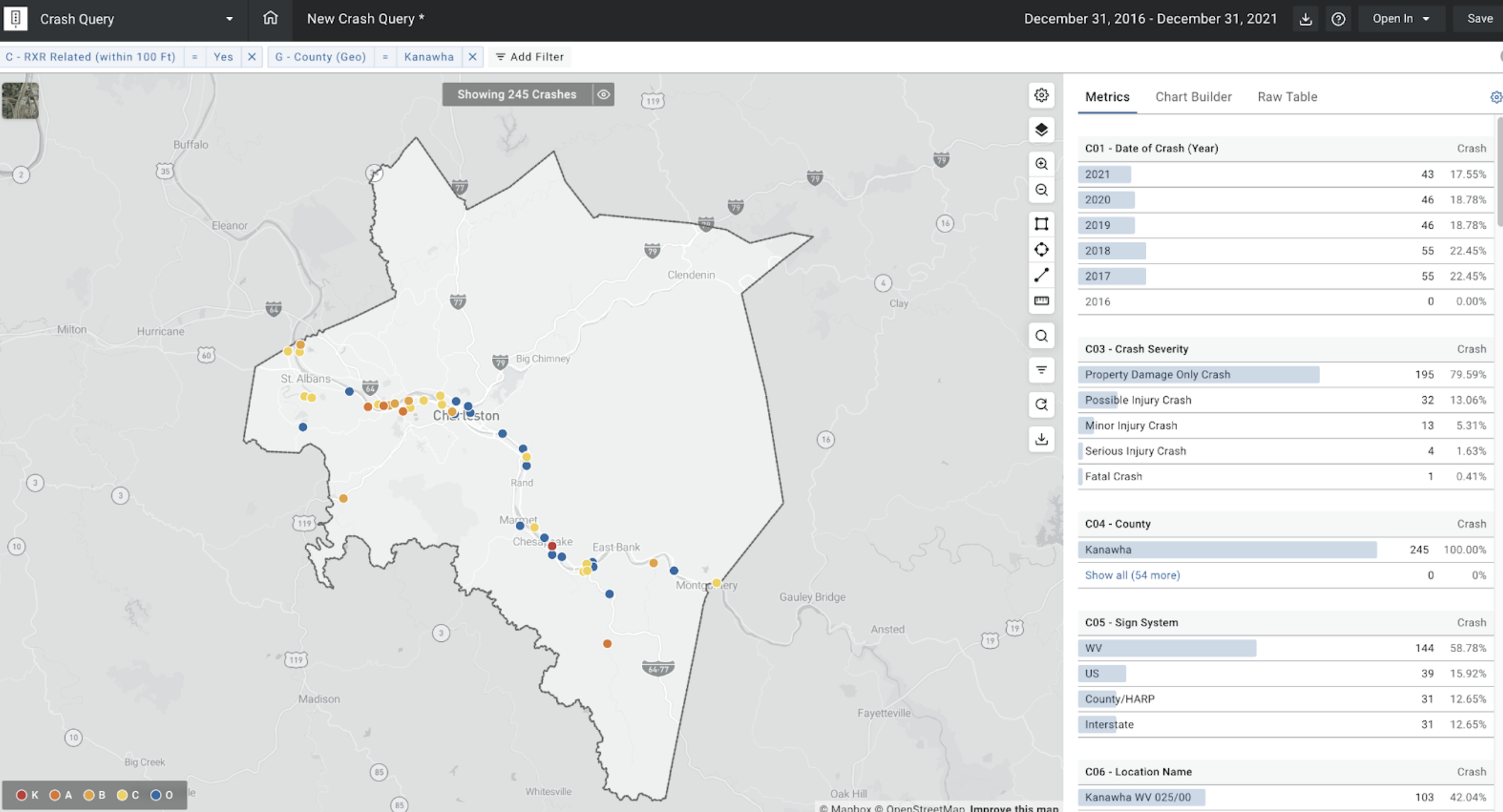
(A Crash Query displaying the near-railway crashes for a given community)
A custom Railway Crossings filter was created, utilizing the geo-location of each railway crossing across the state. This filter identifies all crashes that occurred within 100 feet of each railway crossing, allowing WVDOT to identify and prioritize areas for potential improvement.
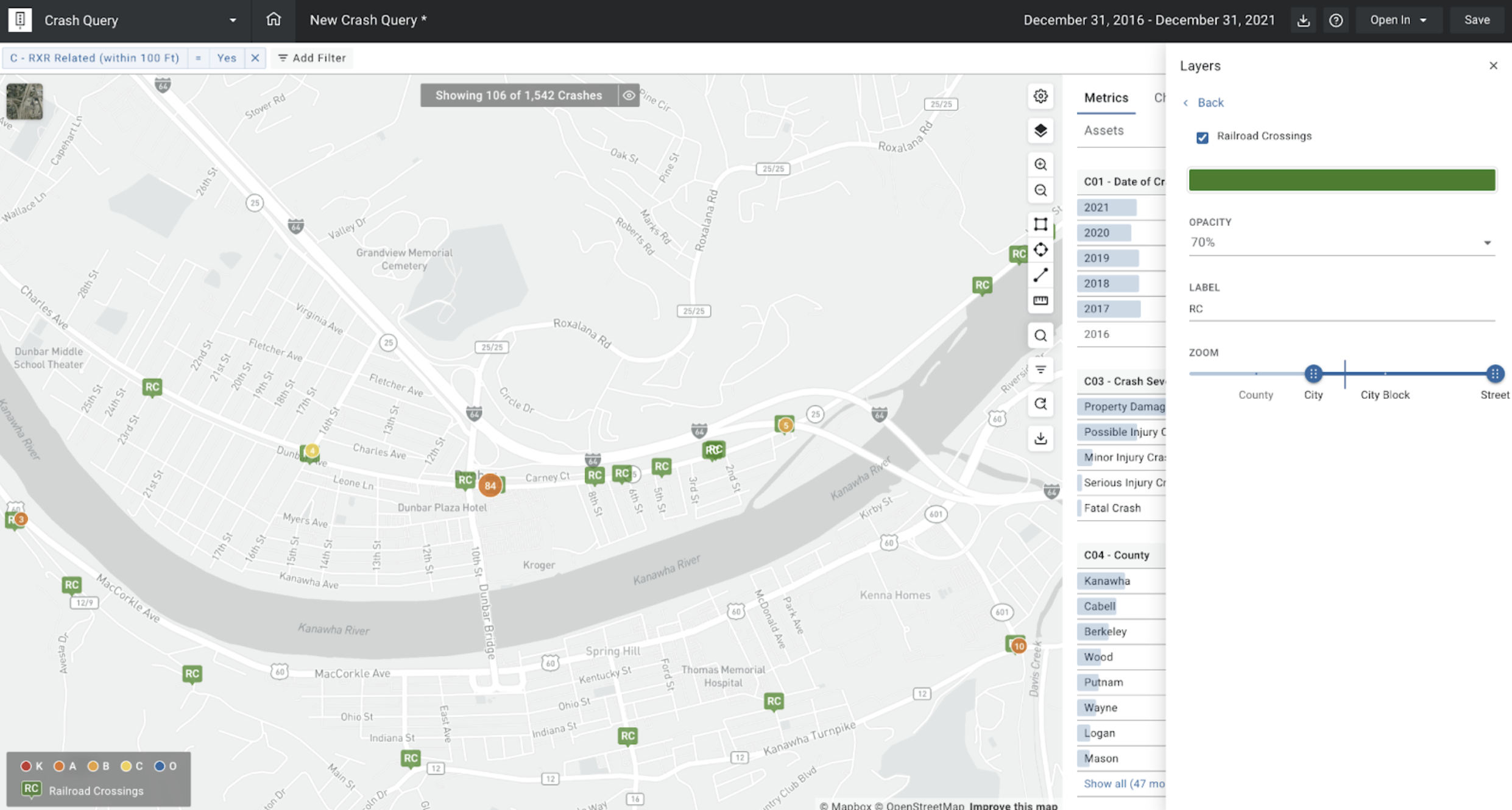
(The Railway crossing asset layer displayed in Crash Query, allowing users to identify any railway crossings directly on the Crash Map.)
Additionally, the location of each railway crossing across the state can be visualized in the asset layer, allowing for a more high-level analysis of the potential impact that railway lines may have on roadway safety.
More information on this topic can be found below: