Implementation Effort
- Requires minimal effort
- Timeline between 2-3 weeks*
* Assuming an agency has an existing, configured AASHTOWare Safety instance and all required data
Our Customer Success team helps agencies turn crash data into actionable insights. The processes below show how they’re making their communities safer.
Local agencies can integrate AASHTOWare Safety into their transportation planning processes.
* Assuming an agency has an existing, configured AASHTOWare Safety instance and all required data
Local governments manage some of the most complex and visible transportation responsibilities in the United States. County and city transportation departments, MPOs, and regional commissions are at the forefront of building safer systems. They are tasked with balancing day-to-day operations while planning for long-term growth, all under increasing pressure to demonstrate results.
At the core of that responsibility is safety. Every community faces residents calling about specific crash concerns, boards or commissions asking for ranked project lists, and grant deadlines that require strong justification for funding requests. To respond effectively, local agencies need more than professional judgment. They need consistent, transparent data to make data-informed decisions.
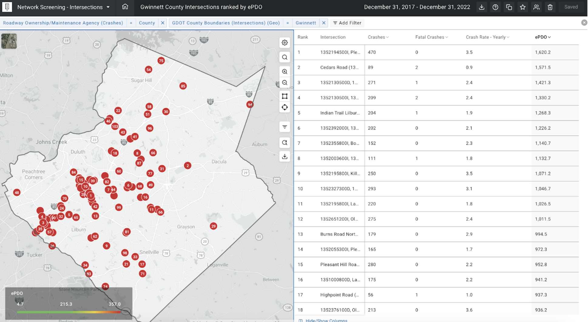
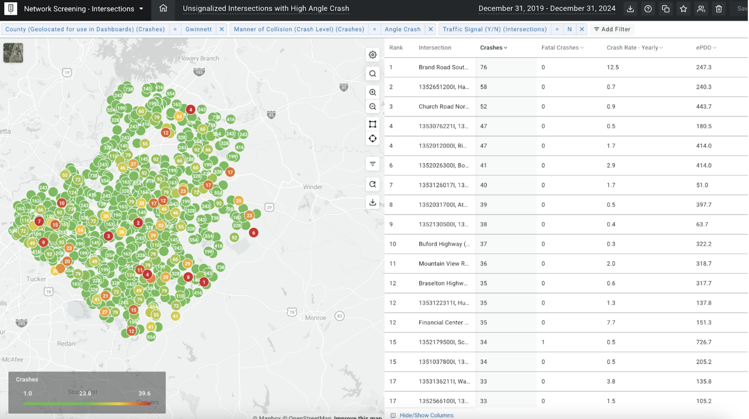
Local agencies are embedding roadway safety screenings into their planning workflows to strengthen project development, secure funding, and build long-term strategies. Using AASHTOWare Safety, planners can quickly run network screenings using performance measures such as Equivalent Property Damage Only (EPDO). This highlights corridors and intersections where crashes cause the most harm, helping agencies direct limited resources toward the areas of greatest need.
The value of this approach goes beyond analysis. Safety screenings create a repeatable process that makes decisions defensible and transparent. When transportation staff members can point to an objective, data-informed performance score for a roadway, it becomes easier to explain project priorities to elected officials, boards, and the public.
Gwinnett County, Georgia, offers a strong example of how this process works at scale. The county manages one of the largest transportation networks in the state, with more than 2,650 miles of roadway, 775 signalized intersections, 200 bridges, and 100,000 roadway signs. Its Transportation Department also oversees sidewalks, transit service, and one of Georgia’s busiest airports. These responsibilities are supported by more than 215 staff and a budget exceeding $77 million.
With this scope of work, Gwinnett’s planning division faces constant demands. Staff may be tasked with responding to resident crash concerns, preparing project lists for sales tax funding cycles, or submitting competitive grant applications to federal or regional agencies.
In one instance, the county had a short deadline to produce a data-supported 10-year transportation plan. Without a streamlined way to identify and rank safety needs, the task would have been impossible.
Staff ran safety screenings using AASHTOWare Safety for every corridor in the county. Using EPDO scores and annual average daily traffic (AADT) per lane, they created a systemwide ranking of roadways and assembled a prioritized project list. That list was presented to the Board of Commissioners, giving local leaders a clear picture of what could be accomplished and a foundation for advocating for policy and legislative changes.
By making AASHTOWare Safety a standard part of its planning process, Gwinnett County has been able to meet the unique challenges facing local transportation agencies. The county begins nearly every significant planning effort or funding application with a safety screening. Corridors identified as high injury are carried forward into project lists. Each proposed project is accompanied by data showing its relative safety benefit, which has become a standard requirement in the county’s Special Purpose Local Option Sales Tax (SPLOST) process.
This approach not only strengthens Gwinnett’s local funding strategies but also positions the county competitively for outside resources. Safety data is now a fundamental part of submissions for Atlanta Regional Commission funding, federal appropriations, and other competitive grant opportunities. By leveraging AASHTOWare Safety, the county can meet its planning demands, position itself for funding opportunities, and identify projects that align with its system-wide safety goals.
“The mission of the Gwinnett County Department of Transportation is to enhance quality of life by facilitating the mobility of people and goods safely and efficiently. This mission is accomplished by planning, constructing, operating, and maintaining aviation, transit, and surface transportation systems in Gwinnett.”
– Gwinnett County Transportation Department Mission Statement
Gwinnett County illustrates how local agencies can transform safety data into a practical tool for planning and policy development. By embedding safety screenings into everyday workflows, staff are no longer relying solely on perception or urgency. Instead, every decision is supported by clear, measurable outcomes.
Other counties, cities, and MPOs are adopting this same model. The result is a more consistent approach to safety, stronger justification for project selection, and greater confidence in both local and regional investment decisions.
As transportation agencies continue to face increasing demands and limited resources, the ability to generate transparent, data-driven safety priorities will remain essential. Gwinnett County demonstrates what’s possible: a system where safety is not just a goal, but a measurable and repeatable component of every planning decision.